
PAS128 Utility Surveys
Get in touchAt Surveying Engineer, we furnish high-fidelity subsurface detection protocols to assist site managers and across the UK in securing their construction environments. We focus on locating hidden services using non-destructive technology to ensure your groundwork phases proceed with zero accidents.
By delivering precision-led spatial data, PAS 128 utility surveys empower you to meet strict legal safety standards while protecting your project from the high costs of infrastructure damage.
Where are PAS 128 Utility Surveys Mandatory?
Implementing PAS 128 utility surveys is a prerequisite for any professional site where intrusive groundworks or structural foundations are scheduled to ensure safety. We frequently deploy our specialists to highway infrastructure projects and major industrial builds where the presence of high-pressure gas or electric mains is common.
In urban environments, this technical oversight protects existing assets and prevents the public disruption caused by utility failures. By mapping buried networks, we ensure that subcontractors work safely in a verified environment.
When should You Order PAS 128 Utility Surveys ?
Scheduling PAS 128 utility surveys should ideally happen during the feasibility or pre-design stage to ensure that buried constraints are factored into architectural layouts. Getting this information early identifies project bottlenecks, which prevents the need for redesigning foundations after a strike occurs.
It is also essential to refresh your data following major site clearances to confirm that markers are still accurate. Proactive surveying mitigates the risk of fatalities and maintains compliance with HSE guidelines.
Which Technical Phases define PAS 128 Utility Surveys?
A modular suite of detection and analytical phases is supplied through PAS 128 utility surveys to yield a detailed spatial record of the subsurface:
Desktop Record Consolidation – Gathering and digitising statutory maps from utility providers to identify potential asset corridors before arrival.
Electromagnetic Signal Tracing – Utilising active induction to follow the specific path of conductive assets like live power cables and metallic mains.
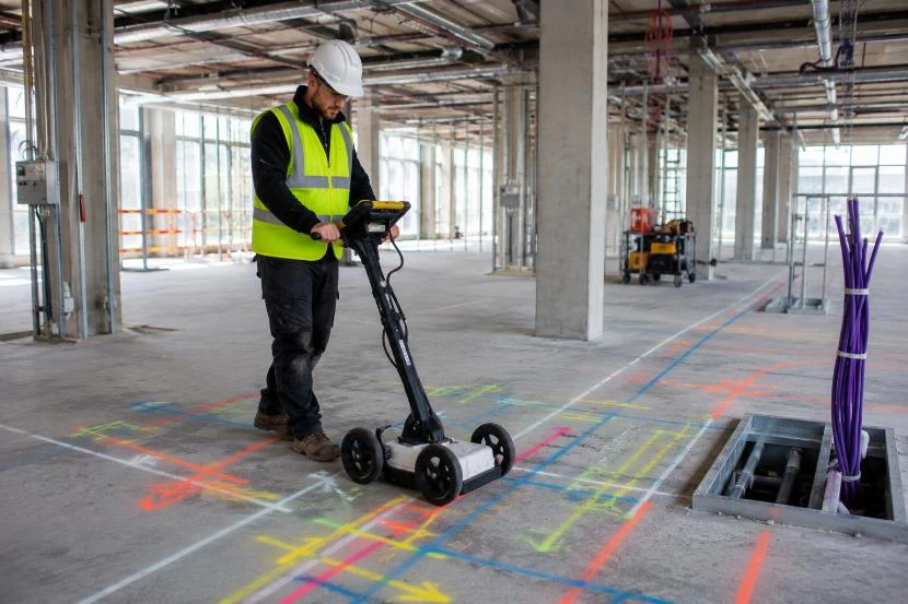
Ground Penetrating Radar – Emitting high-frequency pulses to locate non-metallic assets such as plastic pipes and hidden structural voids.
Topographical Data Layering – Merging subsurface findings with surface features using robotic total stations to produce a coordinate-aligned site model.
Confidence Classification – Assigning each detected utility a specific quality level rating based on the strength of the geophysical evidence.
Can You Estimate the Pricing of PAS 128 Utility Surveys?
The investment required for PAS 128 utility surveys ranges from £850 to £5,500, depending on the square meterage of the site and the complexity of the infrastructure.
Costs are primarily influenced by the complexity of the ground surface, the density of the buried services, and the requirement for 3D Revit integration. Additionally, site-specific factors like the need for night-time traffic management or manual trial hole verification will impact the final engineering fee.
Contact Surveying Engineer to get customised prices for getting utility surveys at your property.
How is the Workflow Managed for PAS 128 Utility Surveys?
Executing PAS 128 utility surveys begins with a meticulous site walk-over to identify signal access points like manholes and valves. Our surveyors utilise a combination of robotic total stations and LiDAR technology to record millions of points, which are then processed against National Grid coordinates.
This technical workflow orthorectified raw signal data, removing the uncertainty of old paper records. This systematic sequence results in a verified digital twin, providing the spatial guide needed for construction.
What Specific Accuracy Levels relate to PAS 128 Utility Surveys?
Technical categories are provided during PAS 128 utility surveys to meet various accuracy and project safety requirements:
Quality Level D – A desk-based search identifying known utility provider records to form an initial risk profile.
Quality Level C – A visual reconnaissance to confirm surface indicators like valve covers match the statutory records.
Quality Level B – The non-invasive geophysical phase using EML and GPR to determine the precise path and depth.
Quality Level A – Intrusive verification where the utility is physically exposed via trial holes to confirm exact dimensions.
Digital CAD Plotting – Converting field detections into layered digital drawings that allow designers to perform accurate clash detection.
How Quickly can You Finalise PAS 128 Utility Surveys ?
Standard development plots can typically be scanned and mapped by PAS 128 utility surveys within three to five working days. We understand that maintaining project momentum is critical, so we prioritise efficient data capture and rapid turnaround of digital drawings after fieldwork.
For high-stakes groundworks, we can provide on-site marking of hazards, which allows excavation teams to start working in safe zones. This responsive service ensures that statutory compliance does not delay your schedule.
Which Code of Practice applies to PAS 128 Utility Surveys?
Adherence to the BSI codes is how PAS 128 utility surveys ensure technical consistency and legal data reliability. These guidelines define the mandatory detection intervals and reporting levels required to provide a reliable map of the physical environment.
Our processes are also aligned with HSG47 safety guidelines, ensuring we capture surface indicators of underground risks. Following these benchmarks guarantees a defensible data set that protects the client from measurement-related financial risks.
Which Commercial Entities benefit from PAS 128 Utility Surveys?
Precision mapping is provided for various sectors through PAS 128 utility surveys to maintain accuracy and prevent accidents:
Civil Engineering Contractors – Requiring accurate data to protect staff during piling, trenching, and complex foundation installations.
Local Planning Authorities – Seeking verified site geometry to assess the impact of new infrastructure on public highways.
Property Developers – Utilising subsurface intelligence to manage the risk of service strikes during the subdivision of land.
Telecommunications Providers – Mapping the continuity of vast underground networks to support effective maintenance and fault finding.
Renewable Energy Firms – Identifying safe routes for wind farm cabling or solar array infrastructure to avoid existing mains.
Why hire Experts for your PAS 128 Utility Surveys?
Independent technical verification is the primary reason why project teams choose PAS 128 utility surveys over standard provider maps. We provide an unbiased audit of site geometry, identifying subtle structural constraints or unrecorded services that internal teams might overlook.
Our professional oversight ensures that the instrumentation used is regularly certified, preventing the cumulative errors that lead to foundation failure. Investing in an expert survey optimises the build cycle, providing the technical assurance needed to build safely.
Contact Surveying Engineer for a consultation to get utility surveys tailored to your organisation’s risks and responsibilities.